
Wylie Previous Residents Sources
A backward Wylie address trail has two layers. Recorded land instruments establish the parcel and transfer sequence. Directories, census schedules, newspapers, maps, probate, and city-held records can then test who was associated with that place at a particular time. The source and its date matter as much as the name. A deed’s recording date is not a move-in date, and a directory publication does not prove continuous presence between editions.
| Source | Years It Covers | Where Held | What It Shows |
|---|---|---|---|
| County Clerk ordinary land search | Current portal; certification date changes | Collin County Official Records | Grantor/grantee, date, type, subdivision or legal description, OCR and image path |
| Historical land records | 1843–1975 | County portal Historical Records route; clerk fallback | Older deeds, plats, and related instruments; image and index availability varies |
| Wylie GIS address points | Service layer labeled June 2023 | City of Wylie GIS | Assigned delivery address, units, municipality, status, county, and Property ID |
| Collin CAD | Current and tax-year search; nightly update notice | Collin Central Appraisal District | Owner, mailing and situs address, legal description, values, exemptions, and IDs |
| Wylie-Sachse newspapers | 1940s–2010s decade facets | Smith Library and UNT Portal | Sale notices, obituaries, names, streets, civic activity, and businesses; issue gaps remain |
| Regional directories | 1878–85 through 1998 selected years | TSLAC, Portal, and regional holdings | Address-to-person or person-to-address context; no complete Wylie-only run located |
| Federal census | Released through 1950 | NARA, Census, and FamilySearch | Household members, ages, birthplace, and enumeration geography |
| Sanborn maps | Wylie 1901 and 1934 | Library of Congress and Texas map references | Structure, use, footprint, materials, and street or house-number context, not names |
| Permits, code, probate, and obituaries | Coverage varies | Wylie departments, court or clerk, newspapers, funeral or church sources | Project dates, heirs, executor, former address, or disposition when accessible |
Start with the current parcel data when the address is known. Start with newspapers or a directory only when a date or surname is already known, then return to the legal description before joining it to a Wylie property. The table preserves the record gaps instead of turning a quiet interval into a claim about past residents.
Wylie Legal Description First
Collin CAD Property Search is the practical starting point for a Collin County Wylie parcel. It can return an owner, mailing address, property location, legal description, Property ID, Geographic ID, subdivision, tax year, and map or plat route. Preserve the legal description exactly. A street number can be formatted differently across a map, directory, and old notice, but a subdivision, block, lot, survey, abstract, or tract description is the better land anchor.
The owner mailing address is not the situs. Tax notices can go to another Wylie address, another city, or a business office. A GIS point can identify the assigned service address and a unit, while the parcel polygon identifies the mapped land. That contrast matters in Wylie because the city extends into Collin, Dallas, and Rockwall Counties. Read the County field in the Wylie Owner Parcels layer before assuming that a Wylie property should be searched in Collin County records.
Wylie Previous Residents Deed Chain
Use the Collin County Official Records Search to move backward through a Collin County transfer sequence. Its Property Records department allows a grantor or grantee, subdivision, document type, document number, and recorded-date range. The County Clerk’s directions are specific: start at the likely purchase year, sort results by recorded date, and compare the deed legal description with the CAD legal description. A surname alone is not enough.
- Record the current CAD owner, situs address, parcel identifiers, subdivision or survey wording, and legal description.
- Search the owner as grantee near the likely acquisition date. Open the matching deed result and verify the legal description before accepting it.
- Record the grantor, document type, recorded date, document number, and description. The grantor is the next name to test as an earlier owner.
- Search that earlier party as grantee to locate the prior acquisition, keeping the same legal description in view. Search plats when the lot, block, or subdivision wording changes.
- For a broken chain, test deed of trust, release, affidavit of heirship, probate, divorce decree, or foreclosure notice. If the parcel is in Dallas or Rockwall County, route the next step to that county’s custodian instead.
- Grantor / grantee
- The grantor transfers an interest in the instrument; the grantee receives that interest. In a purchase deed, the current owner is normally the grantee and the seller is the grantor.
- Chain of title
- A documented sequence of instruments connecting one land interest to an earlier one. Each link must match the same legal description, not merely a similar address.
- Legal description
- The survey, abstract, subdivision, block, lot, or tract wording that identifies land. It is the most stable bridge when Wylie street text changes over time.
A result image can be an unofficial watermarked view. The clerk’s cart, registration, and payment route is required for an unwatermarked printable PDF, and a downloaded copy is not automatically certified.
Wylie Historical Records Route
Wylie past-resident research has an unusually clear land-record split. The ordinary Collin portal shows a current certification date, but its Historical Records option under Other Services explicitly covers 1843 through 1975. That comparison prevents a common error: treating the modern search screen as the full history of a parcel. The historical route should be checked once a dated Wylie deed chain reaches the earlier period.
The County Clerk land-record instructions describe name or document-number searching, date sorting, legal-description matching, and the historical path. They do not promise a complete digitized image for every older instrument. Ask the clerk about deed books, microfilm, manual legal-description searches, and certified copies when the online trail has a gap. The inspected schedule lists a $10 search fee, $1 per page for a copy, and $1 per copy page plus $5 certification.
Note: The historical portal’s 1843 floor is collection-specific. County genealogy resources cite early tax and probate material from about county organization in 1846.
Wylie Directory Census Pairing
A deed identifies parties to land, not necessarily everyone at a Wylie address. To explore past residents, pair a dated address directory with the nearest available federal census, then add newspapers for the interval between them. The located directory shelf is fragmentary: regional business, city, and telephone material spans selected years from 1878–85 through 1998, with an inspected 1981 Greater Dallas White Pages page and a 1998 Collin County Polk page. No complete Wylie-only city-directory run was located.
Use a simple evidence flow: legal description and street wording → dated directory entry → nearest census household → newspaper or probate check → return to the deed chain. A directory reflects its publication or field period. The census records a household on its enumeration date. Neither one alone establishes a continuous stay. When a surname is difficult to read, test the historic variants Wylie, Wiley, Willie, and Wyley and then verify the scan because OCR can distort names.
The Wylie city directory collections identify the available historical shelf in more detail. For an address-focused question, keep the collection result in the evidence ledger with its date and exact street text.
Wylie Sanborn Address Evidence
Library of Congress Sanborn map guidance helps date the physical context behind an early Wylie address. The Texas Sanborn references name Wylie in 1901 and 1934. A map sheet can show whether a structure stood there, its footprint, construction material, use, street name, and sometimes house-number context. It cannot identify a resident, so it belongs beside a deed, plat, directory, or newspaper rather than replacing one.
The map search supports place, date, edition, sheet, notes, and digital-file research. Compare the map’s street wording with the legal description and any nearby railroad, survey, or post-office reference. This is especially helpful where an address appears to predate a modern subdivision or where a lot has changed use.
The Sanborn research guide illustrates the fields needed to select a place and edition.
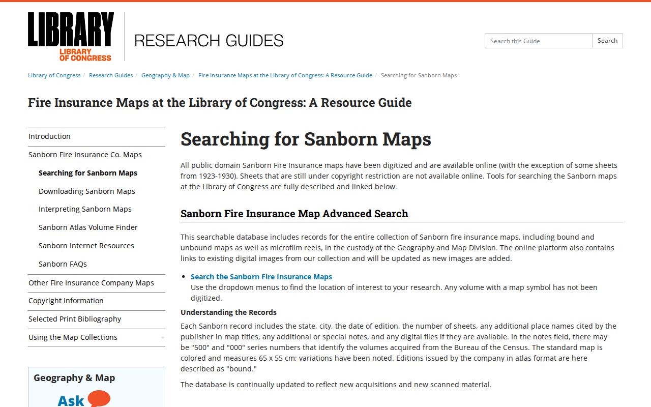
Use a Wylie Sanborn sheet as a building and address checkpoint, then confirm any person or ownership conclusion in the dated record trail.
Wylie Previous Residents News Trail
The Smith Public Library partner collection at the Portal to Texas History holds digitized Wylie and Sachse newspapers with decade facets from the 1940s through the 2010s. The archive is useful between deed or directory years because a sale notice, obituary, school item, church reference, or civic report can connect a name to a street or family relationship. Search a full name and the address or neighborhood, then inspect the page image and adjacent pages rather than relying only on OCR.
A newspaper notice is a dated lead, not proof of a parcel transfer. An obituary or probate file may name a spouse, heir, executor, or former address, then point back to the County Clerk or court record. The county’s probate channel and the newspaper archive complement each other: one documents a legal proceeding, while the other can supply family and place context that the proceeding does not print.
The Texas State Library genealogy resources offer the next institutional fallback for city directories, county microfilm, cataloged family histories, and interlibrary-loan research when a Wylie volume is not in the local collection.
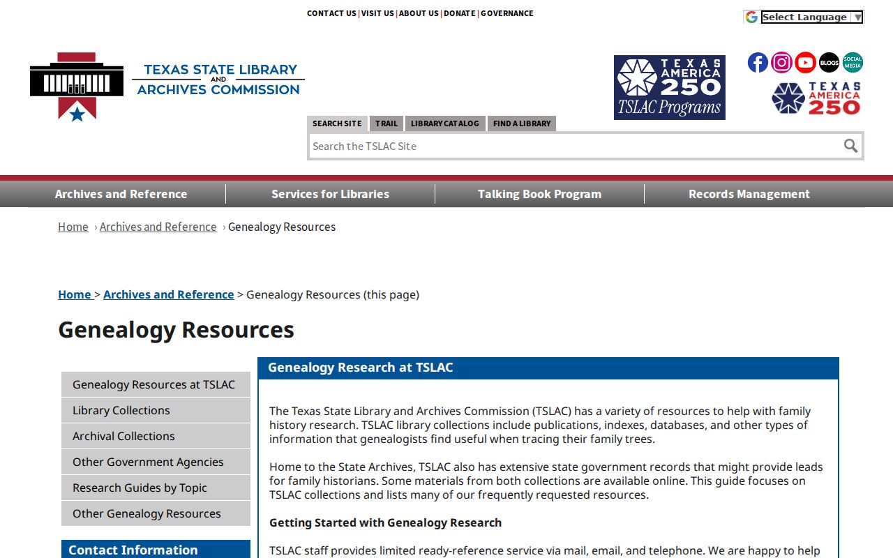
The state library route helps locate a repository and format for an older address source without claiming that it holds a complete Wylie house-history file.
Wylie Address History Gaps
Address continuity is the largest trap in a Wylie past-resident search. Wylie grew around the Santa Fe town site in 1886, the Cotton Belt followed in 1888, and Lake Lavon construction changed rail geography in 1951 according to local history. Older records may use Nickelville, a railroad, a survey, a post office, or a rural route rather than present street wording. Carry both the old wording and the legal description when comparing sources.
Institutional moves show why dates must travel with addresses. The inspected 1981 White Pages places the public library at 108 N. Ballard; the present library is on Country Club Road. That does not establish a move by anyone in a search result. It only demonstrates why an older address needs its own time context. No official citywide Wylie street-renumbering or renaming chronology was located, so a changed number should not be treated as a verified renumbering.
Keep an evidence ledger with the source URL, record date, person and role, street text, legal description, parcel ID, county, and confidence note. A recording event, assessment year, publication year, and notice date all describe different events.
Wylie Previous Residents Boundaries
A Wylie previous-residents trail is not a complete list of everyone who has ever been at an address. A deed names instrument parties, a directory is tied to an edition, and a census is tied to one enumeration date. Protected voter data, motor-vehicle information, utility customer files, sealed matters, and private association membership are outside the ordinary address trail. An absent result can reflect privacy, a different county, an index gap, or a record that was never created.
Use the information for family history, estate research, local history, or personal property curiosity. Do not republish sensitive details from images or pursue a living person through an old address trail.
Lawful use. Texas Penal Code §§42.07 and 42.072 address harassment and stalking. Do not use Wylie past-resident records to threaten, monitor, intimidate, or harass anyone.