
Wylie Street Directory Walkthrough
For a current Wylie street directory search, work from the address outward. A property card can connect the street to a parcel and owner name, but it does not prove that every person associated with an address is there now. The map and deed steps test whether the address, parcel, and county all agree. Voter and historical-directory material serve different purposes: one can identify a registered voter subject to confidentiality rules, while the other can place an address in a dated publication. Keep the returned address text and the record date beside each result.
- Write the exact Wylie street number and street name as returned by the address search, including any unit or directional wording.
- Enter that Wylie address in the property search. If it misses, try the street name alone and narrow with city, subdivision, or tax-year fields where available.
- Use the CAD parcel result to record the legal description, Property ID, Geographic ID, situs address, and owner mailing address as separate fields.
- Open the Wylie GIS layers, locate the same parcel, and read its county field before selecting a clerk or appraisal district.
- Search the appropriate deed index with the legal description and the recorded parties, then sort by recorded date to test the transfer sequence.
- Use the Collin voter route only for registered-voter information allowed by law, recognizing that protected records and unregistered people will not appear.
- For a past address association, search regional reverse or criss-cross directories and then compare the publication date with deeds, newspapers, or census evidence.
That address-to-CAD-to-GIS-to-deed-to-voter-to-directory order keeps a street search grounded in records that answer different questions. It also avoids turning an owner mailing address into a claim about who lives on the Wylie street.
Wylie CAD Street Fields
Collin Central Appraisal District Property Search is the principal address-to-parcel starting point for the Collin County portion of Wylie. Its public search is updated nightly and offers owner, address, ID, and advanced paths. Entering a street number with a street name is more precise than an owner search. The district advises trying a name component alone when an owner query is broad; for address work, its inspected screen omits prefix, suffix, and unit number from the street-name input.
| CAD field | Input | Required | Wylie street use |
|---|---|---|---|
| Owner Name | Text | Optional | Last name first; use one name component if the result set is broad. |
| Street Number | Text or number | Optional | Pair with Street Name for a single Wylie address. |
| Street Name | Text | Optional | Use no prefix, suffix, or unit number on the inspected screen. |
| Property ID | Numeric | Optional | Parcel or account identifier for returning to the CAD record. |
| Geographic ID | Alphanumeric | Optional | Appraisal geographic identifier useful when address wording varies. |
| Subdivision or legal description | Autocomplete or text | Optional | Use to narrow a whole-street search or bridge a plat to a deed. |
| Tax Year and City | Dropdown | Optional | Available on the legacy advanced search for date and place narrowing. |
The Collin CAD search form shows why a street directory needs more than a single name field. A property card can display owner and mailing address, property location, legal description, values, exemptions, tax year, and identifiers. Appraisal values are not a sale price, and an exemption can be consistent with owner occupancy without establishing every current resident.
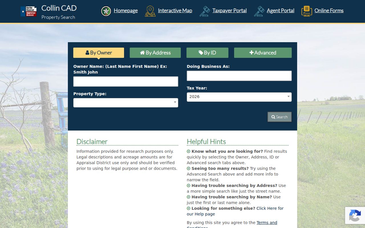
Use the returned Property ID and legal description as the bridge to the map and deed records, not the mailing address alone.
Wylie GIS County Field
The Wylie Owner Parcels layer is the crucial county check before a Wylie street directory search moves to deeds. Its source identifies Collin CAD, Dallas CAD, Rockwall CAD, and City of Wylie GIS, and its fields include County, Appraisal Property ID, Appraisal Geo ID, Document Index Number, address status, and last update. A Wylie label is therefore not enough to select Collin County records.
The related Site Address Points layer tracks assigned service and delivery addresses, road names, units, municipality, status, Property ID, and county. Compare it with the parcel polygon instead of assuming they are duplicates. The point can explain a unit or delivery-address format, while the CAD record anchors the land and the deed identifies the recorded instrument. City mapping is illustrative, so ownership and boundary questions still need confirmation from the CAD and clerk records.
County check. A Wylie address can belong to Collin, Dallas, or Rockwall County. Read the GIS COUNTY field before opening an appraisal or land-record search.
Wylie Street Record Coverage
Each Wylie street record describes a different relationship to an address. The property card and tax account describe the parcel and notice recipient. The GIS layers show geography and service points. A deed records parties to a transaction, while the voter path records registration information subject to Texas confidentiality rules. City permit or code material may add a dated project or case trail, but no official public Wylie permit or code portal was located during research.
| Address record | Keeper | What it can show | Access route |
|---|---|---|---|
| Property card | Collin CAD, or the county CAD named by GIS | Owner, mailing and situs address, legal description, IDs, values, exemptions, tax year | Public search, phone, or in-person contact |
| Parcel and site point | City of Wylie GIS | Geometry, assigned address, county, status, Property ID, district fields | Public map and REST layers; confirm elsewhere |
| Deed and plat | County Clerk for the routed county | Parties, recording date and type, legal description, subdivision, lot, block | Index, copy order, counter or mail; historical route where available |
| Tax account | County Tax Assessor-Collector | Owner mailing address, property location, taxing units, payment status | Tax search and office contact |
| Voter record | Collin Elections for Collin addresses | Registered-voter status, dates, districts, and history in the permitted file | Individual lookup or written Excel-list request |
| Permit or code case | Wylie Building Inspection or Code Enforcement | Project, inspection, notice, or case chronology if releasable | Request by exact address, date, and record type |
| Reverse directory | Library and regional archives | Dated address-to-person or telephone and business context | Digital collection, shelf, or interlibrary-loan lead |
When an address turns up in more than one system, preserve the county, legal description, parcel ID, source URL, and record date. Those fields make it possible to tell a parcel match from a mere street-name match.
Wylie Street Directory Terms
Street records use a few labels that look alike but have distinct purposes. Keeping them separate is particularly important on a Wylie street with units, a corner parcel, a subdivision phase, or a county line nearby.
- Parcel
- A defined piece of land in an appraisal or GIS system. Its ID links map and appraisal research, but the County Clerk deed remains the recorded land instrument.
- Situs address
- The physical property location. It is not the owner mailing address, which may be elsewhere.
- Plat
- A recorded subdivision map. It can connect a lot and block description with the subdivision name used in CAD or a deed.
- Criss-cross directory
- A reverse directory arranged by address, used to find a dated person or telephone association before checking stronger evidence.
For a corner lot, retain both street names. For a unit, retain the number, unit type, unit number, and parent parcel. The Site Address Points service distinguishes several point types and address statuses, which can explain why one parcel has several visible address points.
Wylie Street Deed Chain
The Collin County Official Records Search gives the time layer for a Collin County parcel. Its Property Records search can use a grantor or grantee, subdivision, document type, document number, and recorded-date range. The County Clerk instructions recommend starting at the likely purchase year, sorting by recorded date, and matching the deed legal description to the description from CAD. That comparison is stronger than a common-name hit on a Wylie street.
For a subdivision, switch the department to Plats and search the subdivision or plat name. A regular portal result can open an unofficial watermarked image; a printable unwatermarked PDF requires the cart, registration, and payment route. The County Clerk land-record instructions also direct older research to the Historical Records route and describe name, document-number, date, and legal-description matching.
The County deed index uses grantor and grantee roles, recorded date, document type, subdivision or legal-description text, and an image or OCR path where available. It is a record of instruments, not a census of everyone at an address.
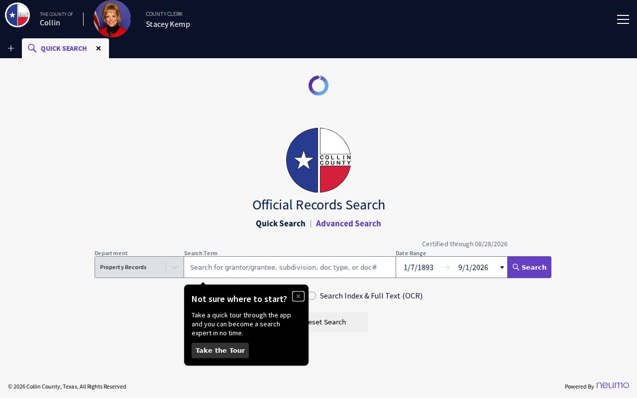
Once the legal description matches, the seller can become the next historic name in a backward deed chain, while later records for that person can point to another parcel.
Wylie Historical Records Route
Collin County separates its land-record chronology. The ordinary portal displays a current certification date, while Historical Records under Other Services explicitly covers 1843 through 1975. That split is a useful comparison: a visible modern search range is not the entire county land-history range. For a Wylie address in the Collin portion of the city, move to that historical route when the dated deed trail reaches the earlier period.
Not every older instrument is promised as a complete online image. If the index or OCR misses a name, ask the County Clerk about deed books, historical records, microfilm, legal-description searches, and certified copies. The inspected fee schedule lists a $10 search fee, $1 per page for copies, and $1 per copy page plus $5 certification. A missing image should be recorded as a gap rather than filled with an assumed transfer.
Note: The 1843 start belongs to the Historical Records route, while the county genealogy material points to tax and probate resources beginning around 1846.
Wylie Voter Street Limits
Collin County Voter Registration Search uses first name, last name, and date of birth for an individual status lookup. It is not a street-browse screen. Collin County also says voter lists can be furnished on written request as an Excel export with registered and mailing addresses, districts, registration dates, status, and voter-history flags. The inspected material did not state the current purchase price.
The file has clear limits. It excludes phone numbers and email addresses, does not reveal ballot choices, and does not identify every person at an address. Active and Suspense status are registration conditions, not proof of current presence. Texas protections can suppress a qualifying voter’s residence address or cause an ordinary lookup to lack an expected match.
Wylie Address Point Checks
Run a Wylie street in several documented forms: number plus street name, name without suffix or direction, subdivision or phase, and the legal-description wording from the parcel card. Save the exact form that returns a record. Collin tax-search guidance distinguishes owner address from property location and says a property-location search should use the number and street name without a street type or direction.
For a whole-street inventory, begin with a road centerline or map extent, collect parcel IDs from the Owner Parcels layer, and verify each result in the CAD. Sequential house numbers do not guarantee adjoining land. Cul-de-sacs, corner lots, drainage tracts, and multiple units can break that assumption. The map is a discovery tool; the parcel card and recorded document supply the proof.
Wylie Street Record Requests
Wylie Building Inspection and Code Enforcement can be a fallback for a dated address question because project, inspection, notice, and case material may be held by city departments. No official public Wylie permit or code search was located. Request a narrow set by exact address, date range, and record type, and ask about retention, releasable fields, and redactions. A broad request is less useful than one tied to a parcel or known project.
The Texas Public Information Act, Texas Government Code Chapter 552, generally directs a requester to the governmental body that maintains the record and does not require the requester to state a reason. The Texas Attorney General overview says records should be produced promptly, with notice if more than ten business days are needed. Judicial records follow their own clerk and court rules, so send deed and court requests to their named custodians instead of a city administrative request.
Wylie Street History Clues
Older Wylie address research needs a date beside every place name. Wylie developed around the Santa Fe rail route in 1886, and the St. Louis and Southwestern followed in 1888. The Wylie News history reports that Lake Lavon construction changed Santa Fe rail geography in 1951. Early records may therefore use railroad, survey, post-office, rural-route, or Nickelville references instead of a modern street format.
Institutional moves can also look like an address change. The inspected 1981 Greater Dallas White Pages lists the public library at 108 N. Ballard, while the current library is on Country Club Road. Preserve the publication date and the exact printed address before connecting an old directory line to a present-day location. No official citywide Wylie street-renumbering or renaming chronology was located, so a number change must be tested with plats, legal descriptions, maps, and dated directory wording rather than presumed.
When the question is a dated household rather than a current street record, the Wylie city directory collections provide the historical shelf and newspaper context.
Wylie Street Directory Boundaries
A Wylie street directory cannot establish a complete household. Deeds identify parties to recorded instruments. CAD identifies an owner or mailing recipient for a parcel. A voter record identifies only a registered voter, and a reverse directory is tied to its publication date. Motor-vehicle information, utility customer files, sealed court material, and protected voter details are not street-directory substitutes. A missing record can be an access limit, a county-routing issue, or a date gap.
Use a public address trail for family history, estate research, civic questions, or property curiosity. Do not republish a visible signature, protected address, date of birth, or other sensitive field simply because it appears in a record image.
Lawful use. Texas Penal Code §§42.07 and 42.072 address harassment and stalking. Do not use Wylie street records to threaten, monitor, intimidate, or harass anyone.